去年夏天爬屏風山就對松針營地念念不忘,一直想找個時間不登頂純露營(廢)
趁過年回老家無聊,決定自己搭公車來走春,分享簡單的公車登山攻略以及英文資訊
公車: 1141花蓮往梨山 一天一班!
花蓮出發時間為5:10 (極早), 在火車站旁的巴士轉運站搭車,可刷悠遊卡,若付現金不找零,約8:40到大禹嶺,需稍微往下踢一點馬路到111.2k新登山口
新登山口到松針營地一路下坡大約2.5-3hr (廢柴慢慢走); 回程就是要補回那600m大概也是2.5-3hr(上坡路上的4G地形害的)
如果是搭公車爬兩天一夜要攻頂的話的話,第一天就得走快一點到營地,並評估營地到山頂來回的時間(走太慢會摸黑),這樣第二天才來得及搭公車,不然建議排三天輕鬆走
回程: 同樣是1141, 公車梨山10:30發車,約11:30到大禹嶺,一天一班要提前去等比較保險,我是在大禹嶺廁所前面上車,大約三點多回花蓮市區
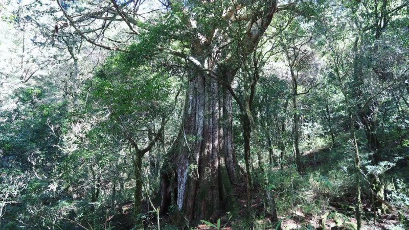
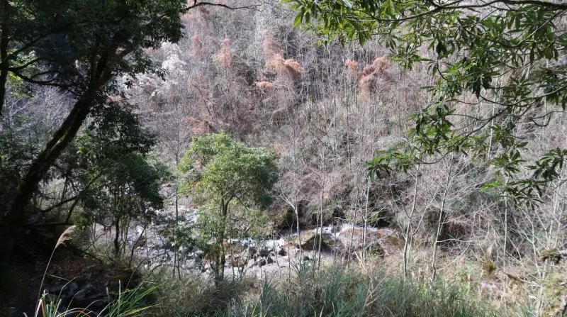
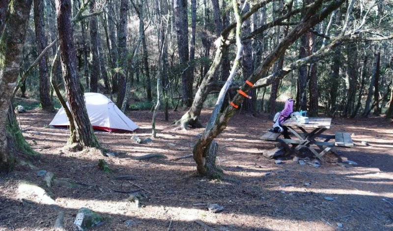
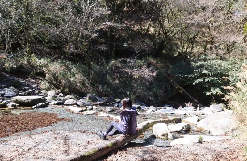
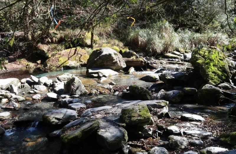
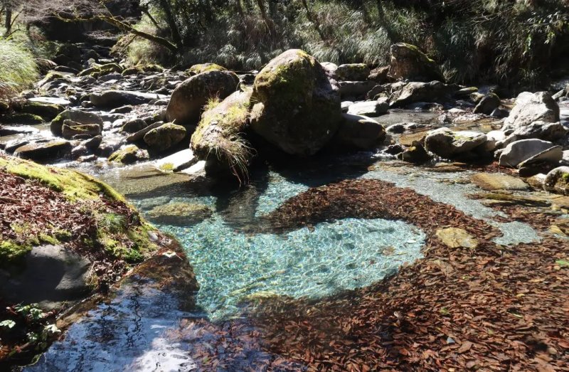
推薦原因: 營地免申請, 重裝到營地的路程短,新路沒什麼危險地形,有水源(營地旁的溪超美),有微弱網路,海拔不高腹地大又擋風,可使用山屋的生態廁所
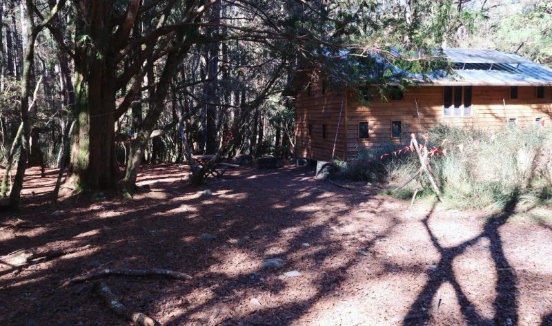
不想重裝也可以提前申請山屋,很乾淨而且有供電
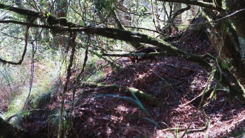
我中午到營地包場耍廢,然後往上爬一點到神木區拍照,回溪邊曬太陽滑手機,還看到山羌,再回營地下午茶,非常愜意
塔次基里溪實在太美,四季都想來露一下,希望分享出來不要爆滿XD
這次搭公車遇到一組菲律賓朋友靠自組也爬了50多座百岳,想說公車登山英文資訊不多,簡單翻譯了一下(翻得不好請不吝指正)
不鼓勵獨攀,請做好功課對自身安全負責,另外推薦戶外安全推廣協會的免費留守人服務。
_________________________________________
Solo-hike to Mt. Pingfeng-Pine needle camping site
Bus info: No.1141 (from Hualien train station to Lishan)/ Only one bus per day!!!
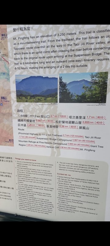
5:10 Hualien bus station (near train station)-> about 8:40 Dayuling-> walk to 111.2k New entry (altitude 2500m) -> go down to the river (altitude 1900m)-> cross the river-> Iron Wire Bridge-> Iron wire bridge Camping site-> Pine needle camping site (altitude 2100m)
about 2.5-3hr
For those hikers with basic hiking experience, the new route to Pine needle camping site is not very difficult. It is a large camping ground within Pine forest, with a new Cabin (permit required), toilet, water, and minor internet. I love the river and giant tree near the camping site.
I did the camping only. If you want to go to Mt. Pingfeng summit, it is better to schedule 3 days. For 2-day-trip by bus, you have to walk fast and do the summit on the 1st day.
Return: the same way from Pine needle camping site, all the way up (about 600m) to the 111.2k new entry-> walk back to Dayuling
about 2.5-3hr
Return bus: No.1141 bus departures from Lishan at 10:30, arrives Dayuling at about 11:30 (One bus per day, please wait there in advance!!!), arrives Hualien city at about 15:00
Since there is no much English hiking information (especially by bus), I did the simple translation for foreigners. If you want to do the solo-hike, please be responsible for your own safety and have proper planning in advance! (Important!)
更多照片請參考IG
https://www.instagram.com/azure0518/
山羌 (特地查了英文是Formosan Reeve's muntjac,也太難)