-
出發日期2023/12/30
-
回程日期2023/12/30
-
相關路線
-
相關山岳
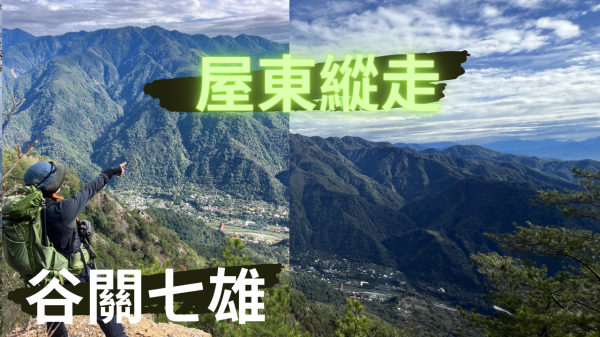
《屋東縱走》台中屋我尾山|東卯山|谷關七雄老三、老五|Guguan Seven Heroes Mountain 影片全集
尾山
心靈鋼琴|忙生活|Busy with Life|Relaxing Piano Music|Piano by PaPa
========== 行 程 總 覽 ==========
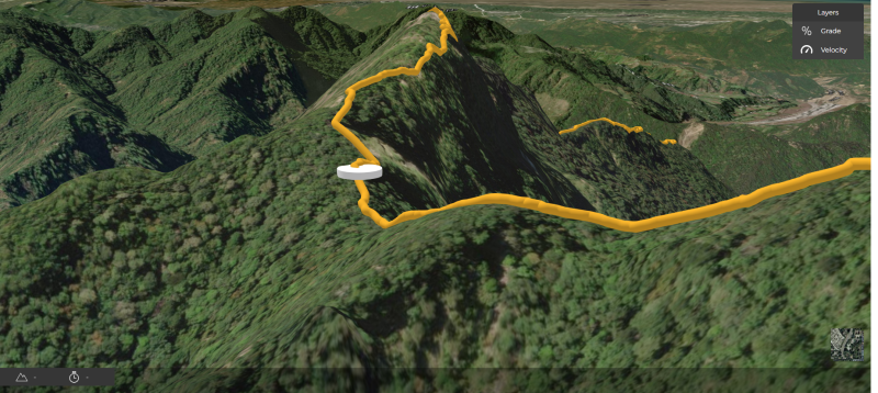
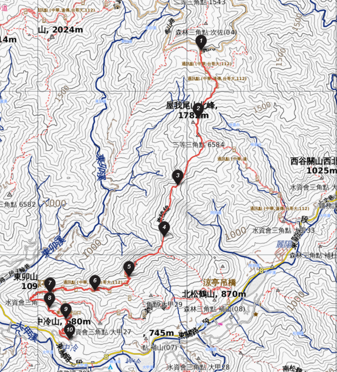 總規劃圖
總規劃圖
 次序5東卯山東南陵
========== 行 程 規 劃 ==========
| 次序 | 時間 | 休息(分鐘) | 里程(K) | 海拔(M) | 備註日期:20231230 |
|---|---|---|---|---|---|
| 1 | 08:45 | 0 | H1993 | 起登,大雪山國家森林遊樂區碑 起登位置:大雪山林道32K https://maps.app.goo.gl/nQKCgQGbS8JE71fg6 Garmin 精準1992 誤差1公尺 | |
| 09:41 | 1.7 | 1.5K 屋我尾山步道 | |||
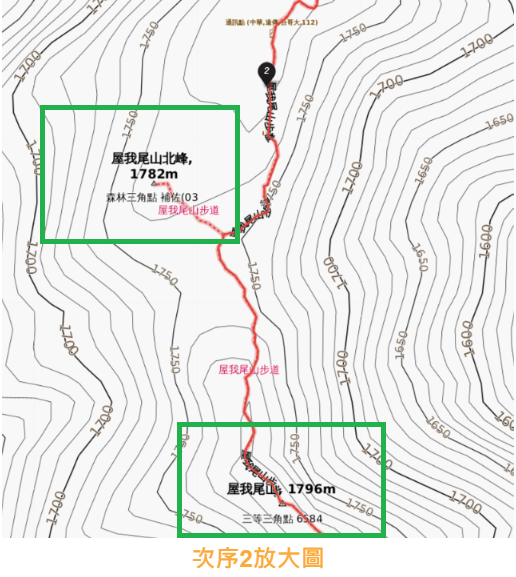
| 2 | 10:17 | 2.3 | H1782 | ▲屋我尾山北峰▲,H1782m,森林三角點 Garmin 精準1769 誤差13公尺 | |
| 2 | 10:26 | 2.7 | H1796 | ▲屋我尾山▲,H1796m,三等三角點,No.6584 Garmin 精準1795 誤差1公尺 | |
| 3 | 11:20 | 3.7 | 中午用餐休畢再出發 | ||
| 5 | 14:34 | 7.0 | H1692 | ▲東卯山▲,H1692m,三等三角點 Garmin 精準1692 | |
| 6 | 15:05 | 7.3 | H1605 | 巨石觀景台 | |
| 7.8 | 15:23 | 7.7 | 6K登山口回程 | ||
| 9 | 17:33 | 13.4 | 東卯山登山口 | ||
| 10 | 18:08 | 15.1 | H687 | 完登,大道院停車場 完登位置:谷關大道院 https://maps.app.goo.gl/ZNuPZk7MKT1xMB148 |
========== 總 計 ==========
●里 程:15.1公里
●時 間:8時33分33秒
●落 差:1305公尺(687~1992)
●總爬升:376公尺
●總下降:1615公尺
路徑規劃(GPX):https://hiking.biji.co/index.php?q=trail&act=gpx_detail&id=2831929
Blog:https://hiking.biji.co/index.php?q=member&member=1409581
========== 山 的 故 事 背 景 ==========
屋東縱走,為谷關地區著名的縱走路線之一,連登谷關七雄的屋我尾山、東卯山二座,屋我尾山共有南、北二處登山口,一般為接駁方便,會選擇南登山口麗陽營區起登者為多,但需陡上1100公尺,較為艱辛;而北登山口為大雪山林道起登,是由高處往下登頂屋我尾山,較為輕鬆。
"The Yatoh Traverse is a renowned hiking route in the Tani Guan area, encompassing the summits of Mount Yagao and Mount Higashibō, two of the seven famous peaks of Tani Guan. Mount Yagao has two main trailheads, one to the south and one to the north. The southern trailhead, starting from the Reiyō Campground, is commonly chosen for its convenient access, but it involves a steep ascent of 1,100 meters, making it a more challenging option. On the other hand, the northern trailhead begins at the Daisetsuzan Forest Road, providing a relatively easier ascent as hikers approach the summit of Mount Yagao from higher ground."
谷關七雄【老三屋我尾山】及【老五東卯山】登山口有2個,一個是北線的大雪山林道,另一個是南線的麗陽;從麗陽上屋我尾短短3.8公里要爬升1070公尺,堪稱谷關七雄裡最硬陡的路線,從大雪山林道前往則一路下坡,相對輕鬆多了。
大雪山入雖然是下坡但也不是很輕鬆,因為一路陡下要不斷的踩煞車,高度落差來到1284公尺,從大雪山森林遊樂區起登經屋我尾山北峰、屋我尾山、屋東分岔路(也接麗陽支線)、東卯山,來到谷關大道院。
"We are embarking on a hike to two of the Seven Giants of Tani Guan, namely the third peak, Mount Yagao, and the fifth peak, Mount Higashibō. There are two trailheads available: one on the northern route via the Daisetsuzan Forest Road and the other on the southern route at Reiyō. Opting for the southern route, starting from Reiyō, entails a challenging 3.8-kilometer ascent with an elevation gain of 1070 meters, making it one of the steepest routes among the Seven Giants of Tani Guan. In contrast, the northern route from the Daisetsuzan Forest Road involves a predominantly downhill hike, offering a relatively easier journey. For this trip, we have chosen to start our ascent from the northern route, and the uphill portion will be covered by a shuttle service.
Descending from Daisetsuzan, while it may be downhill, is not entirely easy. The route requires constant brake application due to its steep descent, with a total elevation drop of 1284 meters. Nevertheless, our group consists of hikers with evenly matched abilities, and we made our way with laughter and ease, with minimal waiting time for fellow hikers. Starting from the Daisetsuzan Forest Recreation Area, we ascended through the northern peak of Mount Yagao, Mount Yagao, the junction of Yagao and Yatoh trails (which also connects to the Reiyō trail), and finally reached the summit of Mount Higashibō, concluding our day at Tani Guan Dadaoin.
In total, this trek involved conquering three peaks and enjoying two scenic viewpoints: the northern peak of Mount Yagao (1728m, Forest Triangulation Station, Auxiliary Point 03), Mount Yagao (1796m, Third-order Triangulation Station, 6584), Mount Higashibō (1690m, Third-order Triangulation Station, Internal Auxiliary Point 220), Daisetsuzan Forest Recreation Area at 32K (1965m), and Tani Guan Dadaoin (700m)."
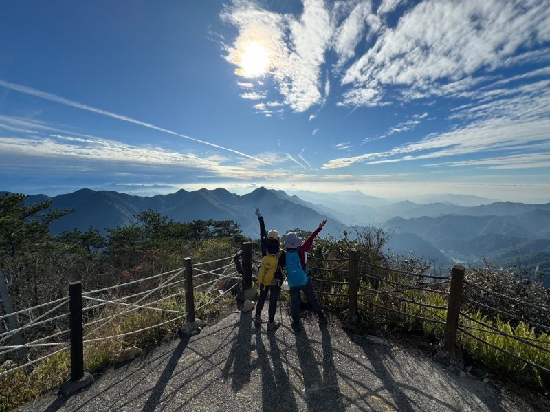
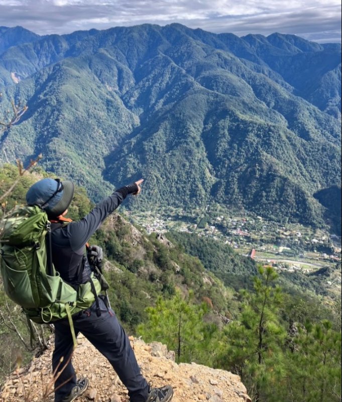
前往東卯山轉角處一景:
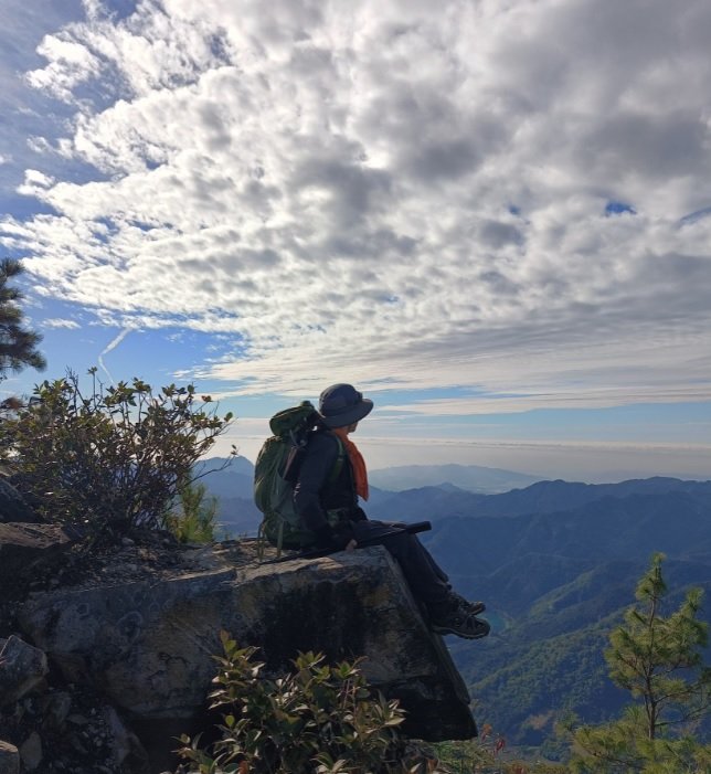
東卯山三角點: