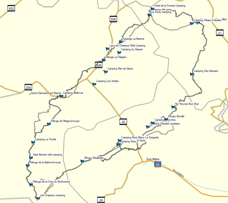
-
相關路線TMB
本文為網友的心得,以下內容不代表健行筆記立場。


| 6 | Camping Grandes Jorasses | Sleep | http://www.grandesjorasses.com/en/ |
| 6 | Rifugio Bonatti | Sleep | https://www.rifugiobonatti.it/ |
| Distance (km) | Elevation Gain (m) | Elevation Loss (m) | Shortcut |
|---|---|---|---|
| 17.17 | 1052 | 661 | "Walk from Courmayeur to Rifugio Bonatti and take the bus to the campsite" Arriva Bus-In and around Courmayeur: This is the bus network you’ll use if you need to take any alternative transportation in Val Ferret or Val Veny (the two valleys in the surrounding area). You can take a bus from La Visaille to Courmayeur to cut out the final hour of walking on Stage 4. This bus can also be used to reach campgrounds that are not located directly on the TMB route. Additionally, you can use the Savda bus to get to either La Fouly or Champex (although you will need to transfer in Orsières and take a Post Bus for the remainder of the journey) |
| Name | Camping Grandes Jorasses |
|---|---|
| Cost (Euro/Person) | |
| Near Site | It is about 3.5 miles down the road past Courmayeur in the town of Plampincieux (local bus #924 will take you right there from Courmayeur). The staff can give you information about nearby trails that will connect you back with the TMB. |
| Description | Bathrooms, sinks, showers, electronics charging, a small shop, and a pizzeria/bar. |
| Booked | http://www.grandesjorasses.com/en/ |
http://www.grandesjorasses.com/en/
https://www.rifugiobonatti.it/
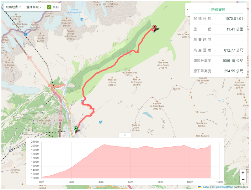
TMB Stage 5 Courmayeur Bonatti
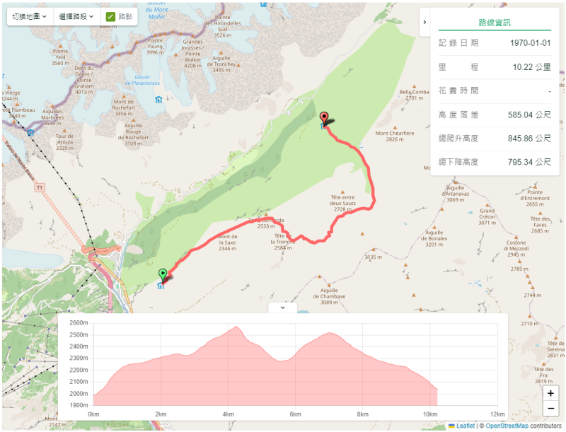
TMB Stage 5 Variant Bertone Mont de la Saxe Bonatti
走支線 <⼤喬拉斯峰>
|

