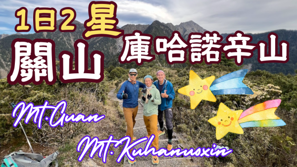
《百岳之美》關山/庫哈諾辛山|Mt.Guan/Mt.Kuhanuoxin|Taiwan Top 100 Mountains
========== 實 際 路 線 ==========
單攻日:梅山管制站➤進涇橋➤3026高地➤關山➤庫哈諾辛山➤進涇橋➤梅山管制站
詳細時間:08:24進涇橋登山口➤09:21庫哈關山叉路(09:26離開)➤11:46關山(12:08離開)➤13:24庫哈關山叉路-14:04庫哈諾辛山(14:19離開)-15:07庫哈關山叉路(17:07離開)-17:55進涇橋登山口
========== 實 際 行 程 紀 錄 ==========
| 次序 | 時間 | 照片 | 休息 時間 (分鐘) | 日期:20240420 (B組) |
|---|---|---|---|---|
| 1 | 08:24 | 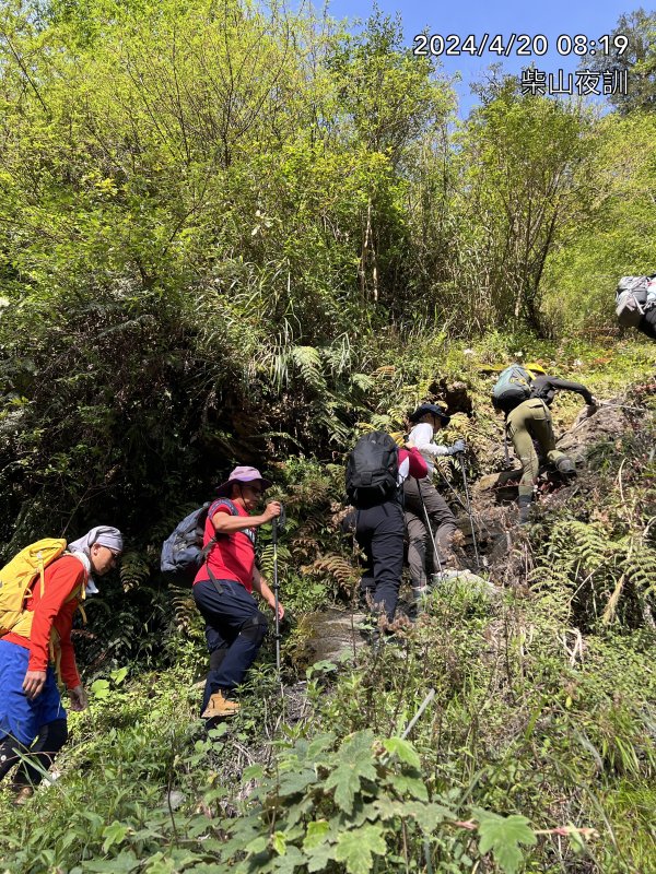 | ▲起登,徑渭橋登山口▲ 分兩組: A:單攻關山 B:單攻關山、庫哈諾辛山 PS:實際B隊起登時間延至約8:24~8:30 | |
| 2 | 09:18 | 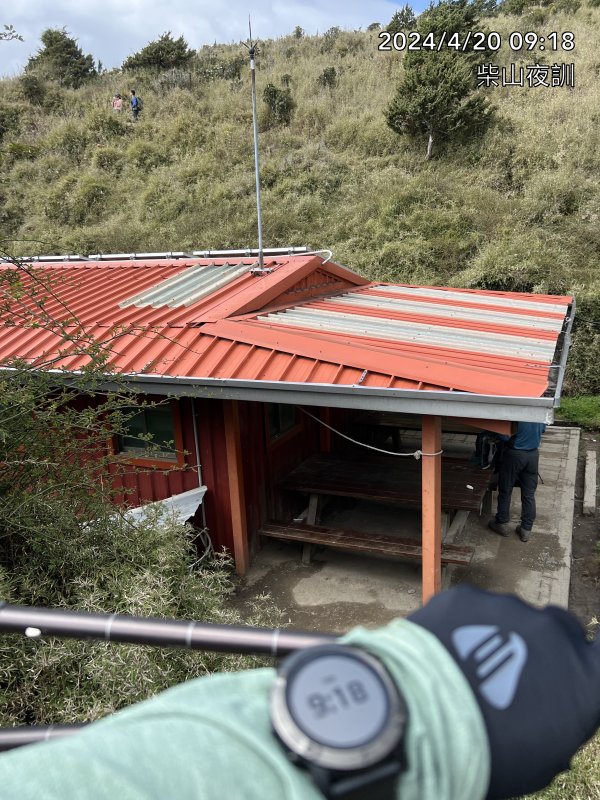 | ▲庫哈諾辛山屋▲ | |
| 3 | 09:21 | 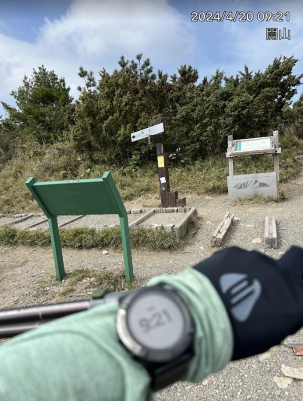 | 5 | ▲關山、庫哈諾辛山三叉點(3026高地)▲ ▲補充水分、鹽糖及上廁所 ▲09:26 離開往關山 |
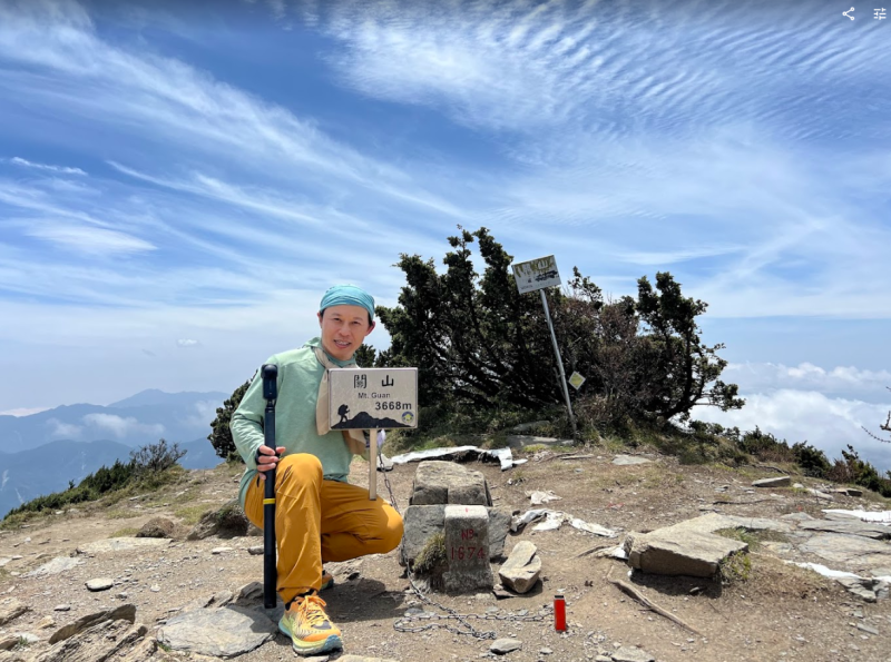
| 4 | 11:46 | 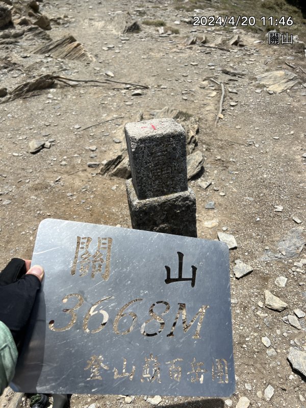 | 22 | ★關山三角點 百岳NO11 H3668★ ▲中午用餐、補充體力、攝影及補充水分 ▲12:08離開往庫哈諾辛山 |
| 5 | 13:24 | 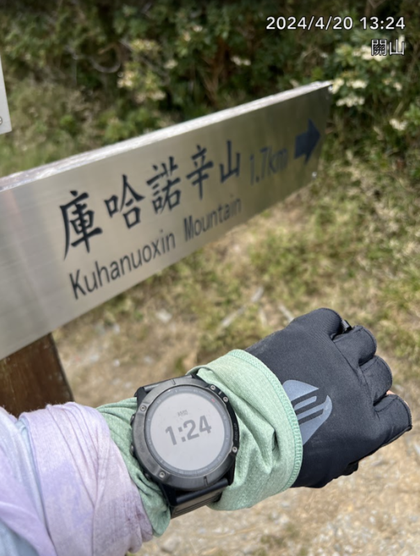 | ▲關山、庫哈諾辛山三叉點(3026高地)▲ | |
| 5 | 14:04 | 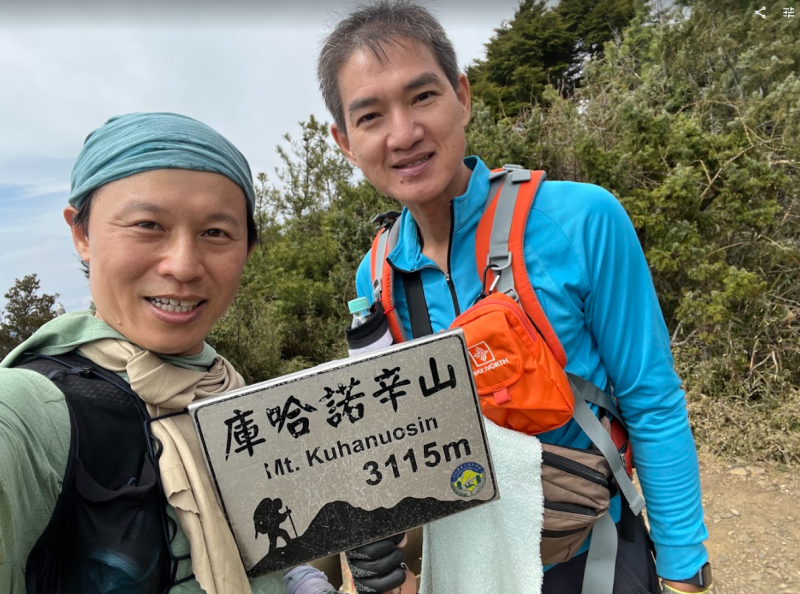 | 15 | ★庫哈諾辛山三角點百岳NO85 H3115★ ▲補充水分、巧克力及攝影 ▲14:19離開往三叉點等待A隊 |
| 6 | 15:07 |  | 120 | ▲關山、庫哈諾辛山三叉點(3026高地)▲ ▲完成單日兩星任務,在此等待A隊友 ▲17:07離開往徑渭橋登山口 |
| 7 | 17:55 | 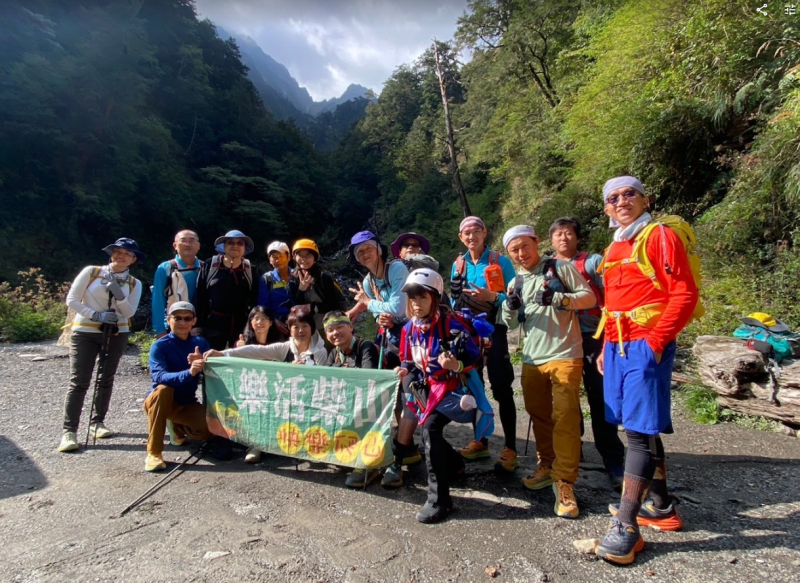 | ▲徑渭橋登山口▲ ▲A及B隊平安下山 |
========== 總 計 ==========
一日2星:關山、庫哈諾辛山
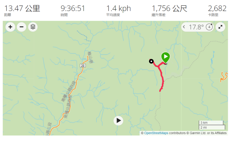
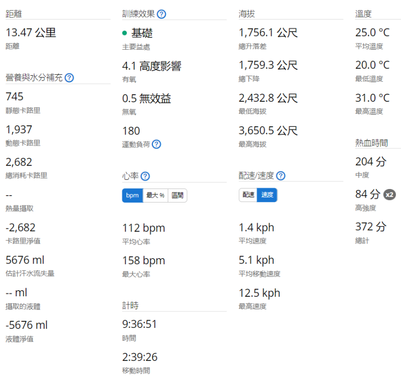
總距離: 13.47 km
總爬升高度: 1756 m
總下降高度: 1759 m
預估總時間(含休息): 9 h 36 m
預估總消耗卡路里: 2682 kcal
路徑規劃(GPX):
Blog:https://hiking.biji.co/index.php?q=trail&act=gpx_detail&id=3132518
========== 山 的 故 事 背 景 ==========
關山(Mt.Guan)
3668m,百嶽排行#11,有南台首嶽之稱,位於台灣台東縣與高雄縣之間,,隸屬玉山國家公園管轄,為台灣百岳名山的「十峻」之一。關山南北觀之如金字塔聳立。
Mt. Guan (3668m) is ranked #11 in the list of Taiwan's top 100 peaks and is known as the highest peak in southern Taiwan. It is located between Taitung County and Kaohsiung County and falls under the jurisdiction of Yushan National Park. It is one of Taiwan's top 100 mountains and is also one of the "Ten Most Dangerous Mountains." From both north and south, Mount Guan rises like a pyramid.
庫哈諾辛山 (Mt.Kuhanuoxin)
3114m,百岳排行#85,與塔關山及關山嶺山合稱為「南橫三星」,為一座山勢平緩東西走向之山峰,也是國家公園西南界山,山頂視野遼闊,向北可朓望玉山、向東可眺望關山大斷崖。上兩座山都是山界南一段縱走的路線之一,登山口皆是在南部橫貫公路139K進逕橋處,抵庫哈諾山屋雖僅有1.7K,但卻有620公尺的落差及數千層的木棧陡梯,確為一大挑戰。
Mt. Kuhanuoxin (3114m) is ranked #85 in the list of Taiwan's top 100 peaks. Together with Mount Taguanshan and Mount Guanshanling, it is known as one of the "Southern Cross Three Stars." It is a peak that runs east-west with gentle slopes and marks the southwestern boundary of the national park. The summit offers expansive views; to the north, you can see Yushan, and to the east, you can admire the sheer cliffs of Mount Guanshan.
The routes to the previous two mountains are part of the southern section of the range traverse. The trailhead for all routes is located at 139K on the Southern Cross-Island Highway near Jinjing Bridge. Although the distance to Mount Kuhanuo Cabin is only 1.7K, there is a vertical drop of 620 meters and thousands of steep wooden steps, making it quite a challenge.
沿途美景:
盧廣仲|刻在我心底的名字|Your Name Engraved Herein|Piano Cover|電影插曲【No.91】
周杰倫|青花瓷|天青色等煙雨 而我在等妳|Blue and White Porcelain|Piano Cover【No.81】
❄️雪落下的聲音❄️|The sound of falling snow|延禧攻略 片尾曲|Piano|鋼琴版【No.33】